
First off, for those of you wondering, the blog has been quiet in the last few days as I have made significant progress on over half of the 34 winter forecasts I will be issuing this late September or early October. I will have limited time around then, so it was best to do the work now.
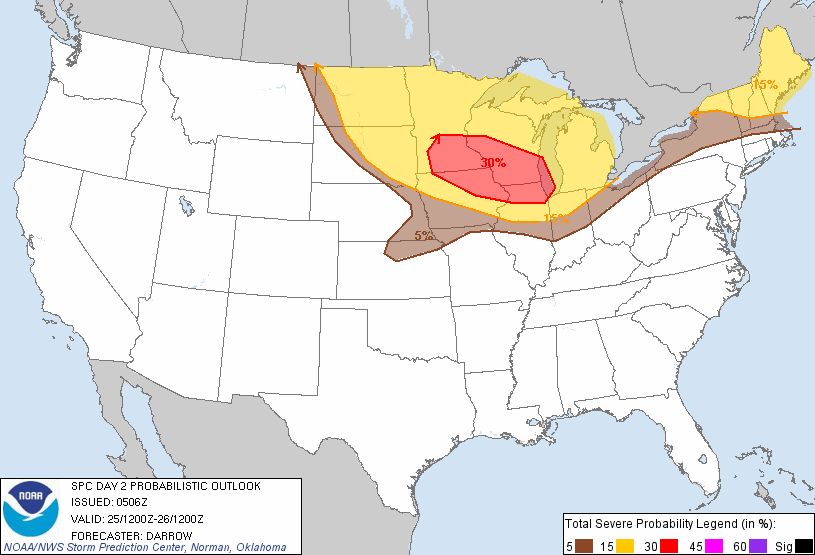
The Storm Prediction Center is indicating there is potential for a higher end severe weather event tomorrow. Shown above is the probability of severe weather within 25 miles of any given point. While the yellow and red areas are encompassed in the same slight risk area, the red area has a higher chance of seeing severe weather than the regions highlighted in yellow.
Model forecasts project the development of severe weather in the red area beginning tomorrow afternoon and continuing into the evening hours. While the resolution on simulated reflectivity forecasts is low, the general premise of a damaging wind/hail event is present in portions of the 30% area, while the western portion of the red area may be the spot for more isolated cells and thus a higher hail threat and maybe even a tornado potential.
Andrew