Monday, January 31, 2011

FORECAST DISCUSSION

AT THIS TIME... A POTENTIALLY LIFE-THREATENING STORM IS PREPARED TO UNFOLD ACROSS THE MIDWEST, PLAINS, AND MIDSECTION OF THE US.

TO FIND DETAILED INFORMATION ON THE STORM, CLICK HERE.

ACROSS THE SOUTH GREAT LAKES... UP TO 24'' CAN BE EXPECTED.
ACROSS THE OHIO VALLEY... UP TO 2'' OF ICE CAN BE EXPECTED, WITH ISOLATED HIGHER TOTALS.
ACROSS DETROIT... UP TO 15'' IS POSSIBLE.
ACROSS THE MIDSECTION OF THE US... UP TO 2'' OF ICE CAN BE EXPECTED.

IF YOU ARE IN THE MIDSECTION OF THE US (DEFINED IN THE LINK ABOVE) STOCK UP ON PROVISIONS NOW!
THIS IS A LIFE-THREATENING STORM.

Chicago Blizzard Warning Discussion

URGENT - WINTER WEATHER MESSAGE NATIONAL WEATHER SERVICE CHICAGO IL 320 PM CST MON JAN 31 2011  ...DANGEROUS MULTIFACETED AND POTENTIALLY LIFE THREATENING WINTER STORM TUESDAY NIGHT INTO WEDNESDAY...  ILZ003>006-008-010>014-019>023-032-033-039-INZ001-002-010-011-019- 010530- /O.UPG.KLOT.BZ.A.0001.110201T1800Z-110203T0000Z/ /O.NEW.KLOT.BZ.W.0001.110201T2100Z-110202T2100Z/ WINNEBAGO-BOONE-MCHENRY-LAKE IL-OGLE-LEE-DE KALB-KANE-DUPAGE-COOK- LA SALLE-KENDALL-GRUNDY-WILL-KANKAKEE-LIVINGSTON-IROQUOIS-FORD- LAKE IN-PORTER-NEWTON-JASPER-BENTON- INCLUDING THE CITIES OF...ROCKFORD...BELVIDERE...WOODSTOCK... WAUKEGAN...OREGON...DIXON...DEKALB...AURORA...WHEATON...CHICAGO... OTTAWA...OSWEGO...MORRIS...JOLIET...KANKAKEE...PONTIAC... WATSEKA...PAXTON...GARY...VALPARAISO...MOROCCO...RENSSELAER... FOWLER 320 PM CST MON JAN 31 2011 /420 PM EST MON JAN 31 2011/  ...BLIZZARD WARNING IN EFFECT FROM 3 PM CST /4 PM EST/ TUESDAY TO 3 PM CST /4 PM EST/ WEDNESDAY...  THE NATIONAL WEATHER SERVICE IN CHICAGO HAS ISSUED A BLIZZARD WARNING...WHICH IS IN EFFECT FROM 3 PM CST /4 PM EST/ TUESDAY TO 3 PM CST /4 PM EST/ WEDNESDAY. THE BLIZZARD WARNING REPLACES THE BLIZZARD WATCH.  * TIMING...SNOW WILL INCREASE IN INTENSITY AND BECOME HEAVY AT   TIMES SOUTH OF INTERSTATE 80 TUESDAY AFTERNOON...GRADUALLY   SPREADING NORTH INTO NORTHERN ILLINOIS BY TUESDAY EVENING.   SNOW...WHICH WILL BE HEAVY AT TIMES...WILL CONTINUE TUESDAY   NIGHT INTO WEDNESDAY MORNING. LAKE ENHANCED SNOW SHOWERS WILL   CONTINUE NEAR LAKE MICHIGAN IN NORTHEAST ILLINOIS WEDNESDAY   MORNING...SHIFTING INTO NORTHWEST INDIANA DURING THE AFTERNOON.   NORTHEAST WINDS OF 25 TO 40 MPH WITH STRONGER GUSTS WILL RESULT   IN BLIZZARD CONDITIONS DEVELOPING LATE TUESDAY AFTERNOON AND   CONTINUING THROUGH THE OVERNIGHT HOURS.  * ACCUMULATIONS...SNOW ACCUMULATIONS IN EXCESS OF A FOOT ARE   EXPECTED OVER MUCH OF THE AREA FROM TUESDAY AFTERNOON THROUGH   WEDNESDAY AFTERNOON. LOCALIZED TOTALS IN EXCESS OF 18 INCHES   REMAIN POSSIBLE...ESPECIALLY NEAR THE LAKE.  * HAZARDS...WHITE-OUT CONDITIONS ARE EXPECTED AT TIMES TUESDAY   NIGHT AS VERY HEAVY SNOW AND STRONG WINDS RESULT IN BLIZZARD   CONDITIONS. SNOWFALL RATES OF AT LEAST 2 TO 3 INCHES PER HOUR   ARE POSSIBLE...ESPECIALLY WHERE THUNDER SNOW MAY BE PRESENT.  * IMPACTS...CONDITIONS WILL RAPIDLY DETERIORATE FROM SOUTH TO   NORTH ACROSS THE REGION TUESDAY AFTERNOON...WITH TRAVEL LIKELY   BECOMING VIRTUALLY IMPOSSIBLE AT TIMES TUESDAY NIGHT AND INTO   EARLY WEDNESDAY MORNING. SNOW IS EXPECTED TO FALL SO HEAVILY AT   TIMES TUESDAY NIGHT THAT PLOWS MAY BE UNABLE TO KEEP UP WITH THE   SNOW...WITH MANY SIDE STREETS AND UNTREATED ROADS BECOMING   IMPASSABLE.  PRECAUTIONARY/PREPAREDNESS ACTIONS...  A BLIZZARD WARNING MEANS SEVERE WINTER WEATHER CONDITIONS ARE EXPECTED OR OCCURRING. FALLING AND BLOWING SNOW WITH STRONG WINDS AND POOR VISIBILITIES ARE LIKELY. THIS WILL LEAD TO WHITEOUT CONDITIONS...MAKING TRAVEL EXTREMELY DANGEROUS. DO NOT TRAVEL. IF YOU MUST TRAVEL...HAVE A WINTER SURVIVAL KIT WITH YOU. IF YOU GET STRANDED...STAY WITH YOUR VEHICLE.  &&  $$  SHEA 

Chicago under a Blizzard Warning

Chicago is under a blizzard warning.
Stay with The Weather Centre as we update our Midwest Storm Page.

Changes in Storm

-No track changes, some moderation in all.
-Slightly lower snowfall from NAM, possibly GFS.

Expected Chicago snowfall: Up to 30''.
General view: 12-30''
In-Depth view: 18-28''.

Sunday, January 30, 2011

Chicago under Blizzard Watch

Chicago is the first area under a Blizzard Watch in the US.
To see current alerts, please click on the MIDWEST STORM PAGE.

Snow Day Bulletin

People in the South Great Lakes and Ohio Valley are in for a snow day.
As well are people in the dangerous icing zone in the StormMap issued.

18z Models Jan. 30

Info for Chicago areas. To find out about your area, look on the Midwest Storm Page.

NAM- Same track.
NAM Snowfall: 30''
NAM QPF: 1.92''

NWS Snowfall: 16-22''
WGN Snowfall: 30''+

STORMAP

Provisions needed

ANYONE AND EVERYONE IN THIS STORM NEEDS TO GO STOCK UP ON FOOD, WATER AND SUPPLIES FOR THIS STORM.
WHETHER IT'S SNOW OR ICE, STOCK UP NOW.
THIS STORM IS DANGEROUS AND COULD BE DEADLY.

HPC QPF Image


Multiply amount by 15 for snow accumulation

Saturday, January 29, 2011

Model Update #2 January 29

0z RUN
(Results compared to 18z run)

-WRF: Coming in a bit west.
-NAM: Same as 18z run.

Special Analysis Feb. 1-3 Storm


Below is a BUFKIT.
The measure on the left is if you melted all the snow expected, that is how many inches of water would come to. Multiply that number by 12 to get the expected snowfall.
The above is for Chicago. You can see how high the expected QPF is, leading to approximately 14-18''.
Below is a more significant image. It is forecast snowfall from the recent 18z GFS run. Notice how much snow falls over the South Great Lakes.
While these amounts may seem ridiculous, remember that the GFS model has been very consistent in the past at least 4 runs, making it the most consistent model of this storm.

The GFS and ECMWF, both the 2 heavy-hitter models, are north, while the NAM/WRF/GEM models are taking a southern track.
The UKMET model is dead in the middle.
Because the GFS/ECMWF models are the big models, I will take a mix of that and UKMET.
A special page is being set up for this storm.

Model Update January 29th

WRF and NAM have fled south, leaving the ECMWF the only one north.

MODEL ANALYSIS #1 Feb. 1-3rd storm

The GEM completely went on its own way.
The ECMWF may have gone south just a hair, but some areas' expected QPF (water equivalent of how much snow falls) actually went up.
GFS did trend a bit north, enough to bump up the expected snowfall totals and QPF as well.
NOGAPS is taking the GFS storm track.
NAM is still with the ECMWF storm track.
WRF also takes an ECMWF track.
While the time frame is still too early for the UKMET, early indications are taking an ECMWF track.

The interesting thing is: Although the GFS may seem far south to people in the South Great Lakes right now, a good foot is expected, and only more if it trends north.

MODEL DISCUSSION
-----------------
While the GFS has been the most consistent, I expect the GFS to trend more north and the ECMWF model only a bit south.
With the current set-up, it is now the ECMWF/NAM/WRF/UKMET? against GFS/NOGAPS
The GEM can be discounted due to its odd structure and track.
The GFS has been holding steady, as the ECMWF has.

It's the South 'camp' (tracks) against the North 'camp'.
Which one will break first?
Stay tuned to the Weather Centre for more information.

Predicted Snowfall Estimates (Feb. 1-3)

GFS: 10-12'' (At least 6'')
ECMWF: 1-3' (At least 6'')
NAM: Following ECMWF (At least 6'')
GEM: 8-12'' (At least 6'')
JMA: 3-5''
NOGAPS: unknown

Model Consensus: JMA model is a strange run, will discount it due to drop in snowfall estimates.
NAM and ECMWF are set on a very strong storm that could allegedly produce up to 3 feet in spots.
The GEM is forecasting 8-12'' and is reportedly trying to move north towards the ECMWF/NAM solution.
GFS solution is the most consistent, but with models and ensembles moving north, it is expected for at least a slight shift north in the GFS track.

MIDWEST FORECAST DISCUSSION #1 FEB. 1-3RD


MODEL FORECASTS
-------------------------

The ECMWF model has moderated itself and is now tracking through South IL.
The DGEX model has pushed northward and is now going through Central IL.
The GEM starts to go north, then suddenly drops to the Gulf Coast and continues on a very changed track.
The WRF, although still too far out in the time frame, says that early indications point to a northerly track.
The GFS says the storm will track along Tennessee moving Northeast.

HPC gives out high QPF rates

Much more interestingly, though, is a couple things for North IL/South WI
1. GFS predicts at least 6'' to fall- currently trending towards 8-12''.
2. ECMWF QPF says 1.75'' to 2'' of snow (17-20 inches of snow!!)
3. HPC QPF image above indicates at least 5-7.5'' of snow.

Model Consensus: A professional meteorologist mentioned that storms like these, although currently tracking south, often track north in the end.
Evidence of that happening is seen in the latest NCEP Ensemble, where all members are north of the 6z GFS.
The ECMWF may be trying to think ahead and stay north in event that the north track does happen.

Friday, January 28, 2011

Notice

The following changes will occur:

The following things will be deleted:
-Winter Storm Page

The following things will be modified:
-The Severe Weather Outlook will now include the 2011 Tornado Forecast.

February 1st-2nd In-Depth Analysis


This is a special in-depth Analysis for the February 1st-2nd winter storm.
This is a very in-depth, and long, analysis, so you can zoom down to find a summary. However, the most detailed information will be found throughout the analysis itself.

We're going to hit it right off with an image from the Climate Prediction Center. This is a map issued today, outlining the projected hazards over the next week or so.
We can see a band of heavy snow extending from the Central Plains back through the Midwest and Southern Great Lakes into New England. A line of icy conditions in the same period will be in the Oklahoma area extending through the Southern Midwest and into extreme south portions of the Northeast.
A heavy rain period in the same time frame will be over the South-Central US and portions of the Southeast US.
This storm will be so significant, the entire east US will likely be affected by this storm. It is projected to be very strong.
The Heavy Snow band outlined above is an area I want to highlight. Due to how strong this storm could be, snow totals may exceed 6'' in many places, possibly touching 12''.
The Heavy rain area will be a benefit for drought conditions, which may improve.
But the most concern is the icy strip in the central US. In the below map made by The Weather Centre, I outline a new map, the Danger Map.
While the above image isn't set in stone, there is certainly a risk for danger for ice in the South Midwest to the Southern Plains and the South Central US. Parts of the the Northeast will also be in the ice danger risk at this time.
The heavy snow risk, while not as dangerous, is still a hazard. I predict that the heaviest totals may occur there, with isolated/scattered totals of 10-14'' of snow. Again, this is a far way out and is subject to change.
Below is the expected precipitation map from The Weather Centre.
I did stretch out the moderate snow areas on this precipitation map but drew back the heavier snow areas. I included the icy conditions where ice should be the most dominant precipitation.
Rain will be in place across most of the East US, but the heaviest may be north of the Gulf coast, where the drought is not as severe.
However, these will all be junk if the storm track changes. So, without further ado, I give you a preliminary look at the expected storm track for this storm.
Please realize, and I emphasize this, the storm track is a track that I have been the LEAST sure of in all my days of forecasting.
You can see how big the uncertainty area is as soon as the low gets to the South Central US.
You can take your own opinion on this, but I would take something around the line I outlined.
The track is comprised out of all the major models. Below is a VERY PRELIMINARY snow forecast for this storm.
While these totals are subject to change, I am confident in, at least, a 1-2'' range in the 2-5'' area on the map. After that, confidence drops off rapidly.
Again, returning to the main concern, is freezing rain and sleet, which comes to the risk of icing. This is a VERY PRELIMINARY IceCAST below.
I have outlined an area of severe icing potential as well as a potential for up to .25'' of ice.
I heavily stress that if you are in the danger of severe icing area, PLEASE keep up to date on all weather updates. Whether from The Weather Centre or somewhere else. This could be deadly in those areas.

Summary: Severe icing could occur in the Central Plains west to the East Coast. Heavy Snow is possible north and heavy rain south.

Possibility of the Feb. 1-3rd storm tracking farther north

This is a question i first asked myself.

Looking at various models and ensembles, I have concluded that the possibility for the storm firing north is a potential, but not as much as it would be to be favorable.

Have a Question?

Do you have a question you've wanted to ask about weather?

Ask here!
Just post a comment under this post and we'll respond -possibly with your question- on a post with an in-depth answer.

So ask away!

CMC finally wins out; model consensus forms

The CMC, which was the only model to have a storm explode over the Great Lakes/Ohio Valley region, has won out over the other models.

The ECMWF, GFS, CMC, NOGAPS models are now all in agreement that a very strong low pressure system will head up somewhere in the Ohio Valley after crossing through South Illinois.

While the NOGAPS is farthest south in this transistion north, it is also the most powerful.
The ECMWF and GFS seem to be in very good agreement with each other over what a current track would be.

The ECMWF is northerly, but it is quite a contender.
I will keep in some CMC model, since it has been forecasting this pattern for the last couple days.

Thursday, January 27, 2011

ECMWF changes mind, but other models already pushing north.

The ECMWF has changed its mind for the Midwest/ Ohio Valley storm, but the CMC, NOGAPS models had already latched on to some of that ECMWF pull north.

Current thinking is that the storm will not have a sure track until Sunday or Monday.
However, The Weather Centre will continue to issue graphics to keep you updated.

A forecast discussion will be issued this afternoon.

Wednesday, January 26, 2011

Aggressive ECMWF model ignites snowstorm potential for Midwest

The ECMWF model, considered a leader in winter storms, is taking a big and bold step to take a very strong storm through the Midwest and Ohio Valley early next week Monday to Tuesday.
The below images are 850mb and temperature forecasts for the winter storm.
The low pressure is well defined in Oklahoma and Arkansas with an intense cold outbreak behind it.
By the next day, the low pressure has moved into the Ohio Valley and even more well defined.
The cold outbreak is very intense by now. Below is a map made by The Weather Centre.
Here at the Weather Centre, we are expecting, should this storm develop, the above areas would be under a risk of precipitation.
It would be a wide swath of snow to the north and rain to the south.
The situation will likely change, so find more information on the Winter Storm page as this develops.

Tuesday, January 25, 2011

Current Severe Weather Situation (Jan 25)

As of 4:42pm CDT, a squall line was moving through Florida with a tornado watch in effect.

Monday, January 24, 2011

Rest Of The 2010-2011 Winter Forecast


Looks like we're close to the half-way point in winter, and The Weather Centre is here to bring you the rest of winter forecast.

The CPC and Accuweather have given a good look at what can be expected for the rest of winter. Combined with typical La Nina conditions, this should be a fairly accurate forecast.
Below is The Weather Centre's forecast for the rest of winter.
Cold and snowy conditions should remain for the rest of this winter across the Great Lakes, Midwest. I stretched it a bit south due to the risk of farther stretching storms as we have seen this winter.
I did keep the warm, dry section in place.
For the Southeast, occasional cooler periods can be expected due to the proximity to the Midwest and Great Lakes.
Arctic outbreaks may become more frequent as the winter lags on, also bringing that cooler period risk to justice.
Of concern is in the Northeast, where I did place the risk for more winter storms in the event of more big, strong winter storms.
Wet and Snowy conditions are expected in the Northwest as more storms begin to come back to the area.
The Southwest should remain dry for the rest of this winter.
In a winter of craziness, a normal period may come to settle in the Rockies and west Plains.

Don't forget to vote on the poll on the left sidebar and watch for the Spring forecast coming in early to mid February.

NORTHEAST STORM DISCUSSION

January 24, 2011 Evening
Discussion...
12Z MODEL RUN DID NOT CLEAR UP MUCH CONFUSION.
ONCE AGAIN, GFS MODEL IS THE CLOSEST TO THE COAST. THE NAM BEGAN TO AGREE BUT NOW RELAYS THE STORM WILL FOLLOW THE NOGAPS MODEL AND STAY FARTHER AWAY FROM THE COAST.
AT THIS TIME, THE SNOWMAP AND ICEMAP ON THE EAST COAST STORM PAGE HAVE BEEN BASED ON THE GFS MODEL.
ADDING TO AN ALREADY DIFFICULT SITUATION, THE GEM AND UKMET MODELS INSTEAD RUN THE STORM NORTH THROUGH THE APPALACHIAN MOUNTAINS.
CURRENT THINKING... I AM TEMPTED TO PULL THE SNOWMAP AND ICEMAP OUT AND REVISE IT.
THE 12Z ECMWF MODEL DOES GO WITH THE GFS, SO WILL KEEP THE ICEMAP, SNOWMAP IN PLACE.
NO SURE-FIRE SITUATION IS FOR SURE, BUT...AT THIS TIME, AM LEANING FOR THE GFS TRACK AS THE NCEP ENSEMBLE AND SREF ENSEMBLE MEMBERS AGREE.

East Coast Storm Page

A page has just been created for the East Coast Storm this week.
It contains the new IceCAST and SnowCAST.

NORTHEAST WINTER STORM DISCUSSION

IN THE 00Z MODEL RUN, THE GFS MODEL WAS THE CLOSEST TO SHORE WITH THE STORM AS IT MOVES UP THE EAST COAST. HOWEVER, THE NAM AND NOGAPS MODELS ARE FARTHER AWAY FROM THE EAST COAST THAN THE GFS.
THE BIG PLAYER, THE ECMWF MODEL, HUGS THE COAST VERY TIGHTLY, COMING WITH THE GFS MODEL.
THE GFS AND ECMWF BEING THE TWO BIGGEST MODELS, IT'S SAFE TO SAY THAT THE STORM SHOULD OCCUR.
IN THE 06Z RUN, WHICH IS NEWEST, THE NAM GIVES IN AND IS BUDDY-BUDDY WITH THE GFS, BOTH CLOSE TO SHORE. SHORT RANGE ENSEMBLE MEMBERS HAVE ALSO TAKEN THAT SOLUTION, YET THE NCEP ENSEMBLE REMAINS MIXED.
AT THIS TIME, I DO BELIEVE IT IS SAFE TO SAY THAT THE NORTHEAST STORM IS LIKELY AT THIS TIME.

Sunday, January 23, 2011

Weather Explained: Why Storms get Stronger on the East Coast

Storms get stronger on the East Coast because of the moisture in the Atlantic Ocean.
The moisture is open and feeding into the storm system, and the storm openly strengthens.

Forecast for the next 7 days (To January 30th)

Over the next 7 days, I do expect a cooling trend to begin in the Southeast/South Central US region.
At the same time, I predict a the West Coast and the Rockies to become under a warming trend. The Plains and Midwest back through the Ohio Valley, along with the southern sections of the East Coast will likely be influenced by this sudden colder air mass in place over the South US, so slightly cooler temperatures can prevail.
Nowhere near as cold as what was experienced this week.
More pressing is the potential for a major winter storm on the East Coast back through areas of the Southeast.
While this should be a rain event, Tennessee, Kentucky, and areas around those locations should see more of a snow event.
While most accumulations are preliminary, it should be safe to say that at least 1-2'' is in the realm of possibilities.

Temperatures may dive this week in the South.

HPC anomaly (variation of something) is indicating a drop in temperatures across the South in the upcoming week.
The below image is the maximum of how much temperatures will vary from average over the next week or so.
This is, as a summary, an exaggeration of how much temperatures could be above or below from the average.
We see the entire East US covered in some sort of below normal expected temperatures.
Below is the minimum of what temperatures could change from average over the next week.
Much of the cooler temperature areas have dissipated, even replaced, with above normal temperatures.
Remember, these are estimates, and this is the minimum of what they could change.
For best estimates, combine the two maximum/minimum graphs.
For the above graph, we can see, still, that below normal temperatures are evident across the Southeast.

Combined, it would be a very good guess for temperatures to take a dip throughout the South.

Northeast, South may be hit again with a storm.

The Northeast is indeed under fire for the potential of a winter storm. In this in-depth analysis, we will review the latest data and what temperatures may be to determine precipitation type.

Above is the image for 3 days from now. We can see a low pressure deepening as it moves from the Southeast to the East Coast and begins to slide up the coast.
This does provide some interest for a potential South winter storm, so we will take a look at forecast weather from the NWS.
The above image is Tuesday morning. We see that much of the South will be much engulfed in rain. Areas in Tennessee will be mixed with snow and icy conditions may come together.
Above, 24 hours later, the storm begins to deepen and strengthen and move off the Southeast coast, rain will pretty much dominate the South. Snow will spread over the Tennessee, Kentucky, West Virginia areas.
Below is the storm as it moves along the East Coast. By now it is very strong, pulling moisture from the Atlantic Ocean. The question is also here about what form of precipitation this will be for the Northeast.
Looking at charts that cannot be posted on here, it appears that precipitation will be a mix only RIGHT on the coast, with heavy snow in areas elsewhere, including New York City.

February Long-Range Forecast Posted

The February Long-Range Forecast is about to be posted, and it does have some changes!
Find it on the Long Range forecast page.

Saturday, January 22, 2011

Your Evening Forecast

Tonight across the Midwest, as a low pressure system moves across the Plains, snow will be developing across the southern Midwest.
The snow will be most abundant in south Illinois and areas to the west and east of that area.
Have a happy Saturday evening.

Friday, January 21, 2011

Light snow to impact the Midwest tonight.


A low pressure system currently moving across the Plains will bring snow to the Midwest tonight into tomorrow.
Accumulations will range from a few inches to a dusting.
Chicago, IL will receive a dusting, but St. Louis, MO may receive a couple of inches.
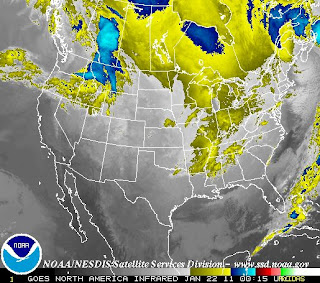
Below is the infrared satellite displaying the system progressing eastward.
As the system treks east, I am expecting it to weaken, as the satellite imagery shows how weak it already is.
So don't be surprised to see some flakes falling; it should make for a nice evening... unless you live up north where the temperature is 0!

Important Notice

It has been decided that, in an effort to place more accuracy in forecasts,
that this blog will now be primarily serving the Midwest US.
However, in the event of a major storm, this blog will be serving the areas needed for discussion.

The Severe Weather Centre will remain directed for the entire US.
The Snow Day Meter will be serving the Midwest, sometimes the Northeast.
The Winter Storm Page may be taken down, but that is still on the table.

Remember to vote on the poll.
It closes in 27 days, and its changes will begin as the votes come in.
It helps me know what you want from us here at The Weather Centre.

Thursday, January 20, 2011

MIDWEST/PLAINS COLD OUTBREAK DISCUSSION

AS AN ARCTIC COLD FRONT MOVES THROUGH THE PLAINS AND MIDWEST TODAY, TEMPERATURES WILL PLUMMET.
WIND CHILLS IN CHICAGO, ILLINOIS ARE EXPECTED TO BE BELOW 0, WITH TEMPERATURES SIMILAR IN NATURE.
GREEN BAY, WISCONSIN WILL HAVE A LOW OF -8 TONIGHT, WITH WIND CHILLS -20 TO -30 BELOW.
MINNEAPOLIS, MINNESOTA WILL RECEIVE TEMPERATURES FROM -15 TO -22.
ALL PEOPLE IN THE MIDWEST AND PLAINS ARE STRONGLY SUGGESTED TO WEAR AS MANY LAYERS AS POSSIBLE.
HATS AND GLOVES ARE ESSENTIAL.
FROSTBITE WILL OCCUR IN 30 MINUTES OR LESS IN THESE CONDITIONS.
THIS ARCTIC OUTBREAK WILL BE ENDING OVER THE NEXT COUPLE DAYS, AS TEMPERATURES BOUNCE BACK UP.

Wednesday, January 19, 2011

Arctic Outbreak January 19th onward Graphic

Midwest Snow Event January 19-21 Watches & Warnings

As we can see, the blue areas are where the heaviest totals are expected. Accumulations surpassing 6'' are possible.
In pink areas, 4'' is not out of the question

Midwest Snow Event January 19-21


This is an analysis for the Midwest Snow Event currently occurring.
Below is the expected snowfall for the next 24 hours.
So, we can see that snowfall totals will be highest across Nebraska, Kansas and Missouri.
A more intense band will be occurring across Nebraska, northeast Kansas back into west Missouri.
While the image cannot be posted for the 24 hours later, the image displays the storm weakening, however 1-2.5'' totals will be widespread in Southern Illinois eastward through Kentucky.

Expected totals should be highest in Nebraska, Kansas and Missouri, with totals also fair in South Illinois and Western Kentucky. The farther west you live in the mentioned areas, the more snow you will receive as the low weakens off on its progression east.

Tuesday, January 18, 2011

Arctic Air Influx begins

The Arctic Air expanses have opened up to the North US.
In the above current analysis, the low pressure associated with the cold fronts responsible with this air continues to move off east, bringing that cold air along.
The high pressure stationed over the Dakotas will not assist much in relief to the cold, but a warm front close to that high pressure may bring warmer temperatures to that area.
We can see how far that cold stretches as the cold front bottoms out in the South, going through the Texas area.
People in the Midwest will see significantly colder temperatures, with cities such as Chicago, Green Bay, and Madison (WI) seeing below 0 low temperatures.

Poll

I have posted a poll above.
I will be closely watching for your votes to better suit your needs.
Please vote so I can fix this blog as best as possible.

Sunday, January 16, 2011

MIDWEST STORM DISCUSSION


18Z RUN OF GFS TAKES SYSTEM INTO CENTRAL IL, PROVIDING HEAVIEST SNOW AMOUNTS IN N. IL, S. WI.
PREVIOUS 12Z RUN OF GFS INDICATED NW IL WOULD RECEIVE 10+'' AT CURRENT STANCE. HOWEVER, SINCE STORM HAS MOVED SOUTH, THOSE AMOUNTS MAY BE MORE WIDESPREAD.
AT THE NEXT RUN (0Z), BEST DATA CAN BE EXPECTED AS SYSTEM IS FULLY ONSHORE.
WITH CONFIDENCE, WILL NOW MOVE MIDWEST STORM ESTIMATE TO 10 (practically guaranteed).
FOR A BETTER IDEA ON WHERE THE MOST SNOW WILL OCCUR, THE AREAS ABOVE THE RED LINE WILL GET THE HEAVIEST SNOW, WITH THAT HEAVY SNOW ZONE STOPPING AT SOUTH WISCONSIN.
ACCUMULATIONS COULD BE AS HIGH AS 6'', WITH LOCALIZED TOTALS MORE THAN THAT.

Midwest winter storm bulletin- 12z run is more south

Saturday, January 15, 2011

Midwest Winter Weather Discussion

A WINTER STORM IS POISED TO AFFECT THE MIDWEST AREA MONDAY INTO MONDAY NIGHT.
AT THIS TIME, GENERAL CONSENSUS IS FOR A TRACK TO RANGE FROM THE WI/IL BORDER TO NORTHERN WISCONSIN. ECMWF MODEL HAS CREATED A COMPROMISE THAT APPEARS TO BE SMOOTH ENOUGH TO WORK.
HEAVIEST SNOW NOW APPEARS LIKELY IN THE WISCONSIN AREA. HOWEVER, IN THE SOUTH WI/ NORTH IL AREAS THAT DO RECEIVE AN ALL SNOW EVENT, A RESPECTABLE SNOW IS NOT OUT OF THE QUESTION.
THE FARTHER SOUTH YOU ARE FROM CENTRAL WISCONSIN, THE LOWER SNOW RATIOS, MEANING WETTER SNOW AND LESSER ACCUMULATIONS.
I AM NOT TOO FOND OF THE ECMWF ATTM, DUE TO A MAJOR FLUCTUATION OVER THE LAST 2-3 RUNS THAT MADE ME LOSE SOME CONFIDENCE WITH SETTING A DEFINITE TRACK.
HOWEVER, SINCE A SLIGHT MAJORITY OF ENSEMBLES AGREE, I WILL LEAN TO A CENTRAL/SOUTHERN WISCONSIN TRACK, ADDING IN TO THE SOUTH PORTION DUE TO A CONSISTENT GFS THROUGH THE LAST 3-4 RUNS.

Friday, January 14, 2011

Notice

The 'computer model' will not be created.

That is the only change.

Notice

All winter storm forecasts will now be posted on the Winter Storm Central.

Daily weather reports will be found on the main blog posts.

Also, I am working to create an extremely simple yet ideal 'computer model'.

Thursday, January 13, 2011

18Z GFS Model Track


I will stick with my graphic issued on the Winter Storm Page despite the GFS.
We're still 4-6 days out.

Significant Midwest Storm (January 17-19th) 00z GFS Analysis

This is the significant Midwest storm analysis potential for January 17th-19th. This is a 00z run, which is fairly old. I will be posting the new 18z run in a new post. So above, a deepening low will be in the Ohio Valley. As it deepens, the snow will become much more widespread and heavy over particularly the Southern Great Lakes.
Above, 6 hours later, the deepening low appears to be pulling moisture from the Gulf of Mexico, thus enhancing snowfall totals in the Southern Great Lakes.
Above, another 6 hours further, the storm begins to what may be collapsing, and the rain/snow line pushes up. However, most areas remain in an area of snow.
Above, still 6 hours further, the storm becomes defined in the Ohio Valley, bringing rain with it. Still, back in the Midwest, a band of heavy snow is thought to be occurring in North Illinois, with widespread light to moderate snow over the entire Midwest.
Finally, in the final 6 hours, the low moves off. The Midwest remains in the snow, and it slowly decreases in intensity throughout the next 18-24 hours.
Another analysis will be posted next.

Wednesday, January 12, 2011

Notice

Because I have seen so many people looking for a Snow Day Meter, I will make one.

Also, the Midwest Snowstorm page is closed and will now revert back to the Winter Storm Central.

The Snowday Meter will launch sometime late this month.

Tuesday, January 11, 2011

In-Depth Cold Outbreak Analysis

This is an in-depth analysis of an expected cold outbreak to the United States.

The first images shown are from the GFS model.


So in the first image above, we can see the jet stream setting up in the Siberian Express format. The jet stream takes a dive in the West Coast, straying south and keeping both them and the North cold.


The above image is of the projected jet stream position.

Monday, January 10, 2011

Step-By-Step GFS Midwest Storm Analysis


In this special analysis, we will use images provided by the EMC.
So, first out, on the below image, is about 12 hours out. We can see the precipitation moving into the Great Lakes and Midwest.
The low pressure will be in South Illinois at that time, weakening to possibly the weakest degree before it moves into the Ohio Valley. Precipitation should be most abundant in the West Midwest at that time.
6 Hours later, the snow finally shoots into the Great Lakes. The low will be in S. IL still, but more there and present. However, the heaviest precipitation will have already moved into the Ohio Valley.
Another 6 hours later, the low has progressed into the far south Ohio Valley, also bringing along the heaviest snows with it. Lingering snow will continue in the West Great Lakes.
Finally, the two lows combine on the East Coast while lingering snow ends in the West Great Lakes but continues in the Ohio Valley.

EAST COAST UPDATE & NOTICE


NOTICE: As of 7:00am tomorrow, the Winter Storm Central will be easing in to focus in on the Northeast snowstorm.
Until then, you can find more information shortly on the new East Coast Snowstorm page.

UPDATE:
Southern low pressure currently centered just offshore of the panhandle of Florida. Storm remains on right track.
At this time, the potential does exist for at least 12 inches of snow in certain New England areas. You can see the depiction on the graphic from the HPC below.
A New England SnowMAP will be issued on the East Coast Snowstorm Page shortly.
Clockwise, the probabilities are as follows. At least 4 inches, at least 8 inches, freezing rain probs, at least 12 inches of snow.

Stunning Northwest Indiana Lake Effect Snow Totals.

Sunday, January 9, 2011

Current Watches and Warnings (January 9th)

Down in the South and Plains, we can see pink for Winter Storm Warnings. Dark Purple is Ice Storm Warning. Blue is Winter Storm Watch. Light Purple is Winter Weather Advisory.

Weather Explained: Phasing

What is Phasing?
Phasing is when two low pressure systems combine into one low pressure system.

Is Phasing dangerous?
It is an atmospheric condition. While it is typically not dangerous, lows that combine can be stronger and more intense.
Under certain conditions, phasing lows can be dangerous.


South US Winter Storm.


A Winter storm is expected in the Southern United States early this week.
Below is The Weather Centre's SnowMAP.
The storm system will stay to the coast, so I would trim back that 2-4'' range, but I'd rather allow some wiggle room for everyone. Below is the Weather Centre's IceMAP.
I did push up ice accumulation amounts just a tad, because ice is very difficult to predict.
And when ice strikes, it's always better to warn and be over the amount than to warn and be under the amount.

The Ice is currently happening today. The system will continue to move east.
You can stay tuned by visiting the Current Weather page, here, on the Weather Centre.

Siberian Express Image

Saturday, January 8, 2011

Siberian Express to Set Up across US.


The Siberian Express is going to set up across the United States.
What is the Siberian Express?

It is when air from Siberia itself comes down into the United States. It creates cold air for a lot of the United States. The Climate Prediction Center has issued images on what the Siberian Express will look like this time around. Images are below.
The first two images are days 6-10. The first one is precipitation, and second one is temperature.

(Green- above normal precipitation. Brown- Below normal.)
(Blue- Below Normal temps. Brown- Above normal temps.

The Siberian Express, while short, may have significant effects on the general North US in terms of precipitation, while the entire US will be affected in the way of colder temperatures.